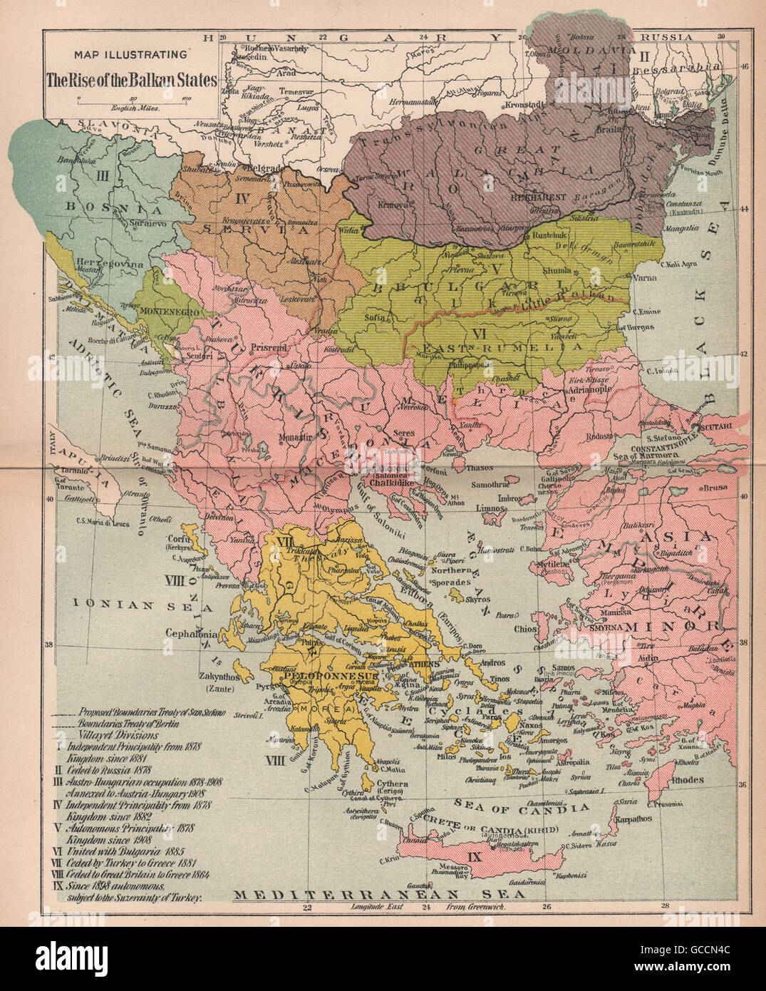
BALKANISATION. Creation of Bosnia Servia Bulgaria Romania Greece, 1910 old map
RFID:Image ID:GCCN4C
Image details
Contributor:
Antiqua Print Gallery / Alamy Stock PhotoImage ID:
GCCN4CFile size:
19.2 MB (1.8 MB Compressed download)Releases:
Model - no | Property - noDo I need a release?Dimensions:
2354 x 2846 px | 19.9 x 24.1 cm | 7.8 x 9.5 inches | 300dpiDate taken:
1910Location:
BalkansMore information:
This image could have imperfections as it’s either historical or reportage.
'Map Illustrating The Rise of the Balkan States'. Artist/engraver/cartographer: Unsigned. Provenance: "Europe Since 1815"; Edited by Charles Downer Hazen, Published by Henry Holt & Company, New York. Type: Antique colour map.